
Santa Catalina Island:
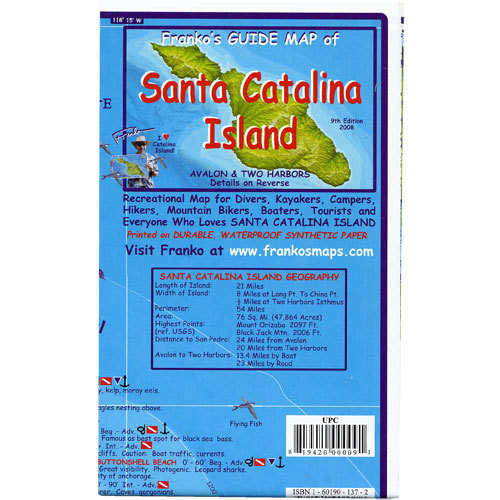
This colorful map gives you everything you need to know about Santa Catalina Island and its surrounding waters. The map is detailed with important facts about the island and what you will find on land or under the water. Complete depth depicted in descending hues of ocean blues to indicate actual ocean bathymetry and depth contours. Shaded relief accuracy is derived from USGS digital elevation models. Each dive spot is accurately described with what you will find when you dive the location along with depth and recommended things to look for. Side one covers the entire island with focus on locations, names and descriptions of diving and snorkeling sites. There are colorful illustrations of fish and other reef creatures found in the Catalina waters.
Side two has larger scale contour maps of Avalon and Two Harbors with additional details, a map of Avalon Underwater Park, and information on transportation to and on Catalina, SCUBA, snorkel and tour suppliers. If you are planning a trip to the Island of Romance this map is a must.
A comprehensive guide to this amazing island off the Orange County coast of California 14" x 21" (35.6cm x 53.3cm) and is folded to a handy 4" x 7" (10.2cm x 17.8cm) size, printed on waterproof rip-resistant synthetic material. This is a shaded relief topographic map. It shows dirt roads, dive sites, snorkel sites, moorings, campground, anchorages and more.