
Orders placed during Passover Holiday (Wed 4/1 after 4PM ET – Thurs 4/9) will ship Fri 4/10. View our holiday shipping schedule.
This item is no longer available.
Review Summary
2022-03-15T10:08:20
Did exactly what I wanted it to do, at an economical price. Charts uncharted ponds and rivers plus marks the bottom structure while doing it. Has good imaging and is user friendly. Don?t know if the more expensive ones will do what this one does for farm ponds and the like. You can produce a chart where none are available.
IRVING H.
11.1 x 6.5 x 2.4" (28.2 x 16.5 x 6.0cm)
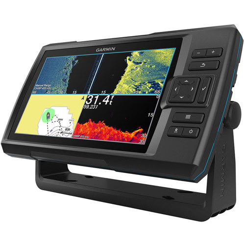
Keyed Design
4.4 x 7.8" (11.2 x 19.8cm); 9.0" (22.8cm) Diagonally
800 x 480 Pixels
WVGA Color
2.4 lbs (1.1kg)
IPX7
Flush or Tilt/Swivel
5000
50,000
50
100
Yes
Traditional: 50/77/200 kHz
CHIRP (Mid and High)
ClearVu 260/455/800 kHz
Yes
Yes
Yes
Yes
Built-In
Yes
Traditional: 50/77/200 kHz
CHIRP (mid and high)
ClearVu 260/455/800 kHz
Yes (Shows Return from the Bottom Up)
Yes
2
Yes
12 to 20 Vdc
0.67 A
1.5 A
8.8
500 W (RMS)
Yes
Yes (Helps Identify Fish Targets)
Yes (Minimizes Clutter; Maximizes Targets)
Yes (Measures Depth of Underwater Objects)
Yes (Real Time Display of Fish Passing-Thru Transducer Beam)
Yes
Yes
753759270728