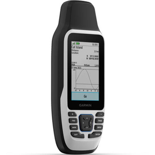

Garmin GPSMAP 79s Marine Handheld GPS

SKU: GRMGM79S

This item is no longer available.

Overview
Compare
Specs
Protection

Reviews about this item

Review Summary

Garmin GPSMAP 79s Marine Handheld GPS Specifications

General

General

Jump to...
  • Display Resolution

    240 x 400 pixels

  • Display Type

    Transflective, 65K color TFT

  • Battery Type

    2 AA Batteries, NiMH or Lithium recommended

  • Battery Life

    up to 19 hours

  • Water Rating

    IPX7

  • High-Sensitivity Receiver

    Yes

  • Memory/History

    8 GB (user space varies based on included mapping on sc version)

  • MIL-STD-810

    Yes (thermal, shock, water); bare unit only

  • Interface

    High speed micro USB and NMEA 0183 compatible

  • Display Size

    W x H: 1.5 x 2.5" (3.8 x 6.3cm)
    Diagonal: 3" (7.6cm)

  • Dimensions

    2.67 x 6.85 x 1.67" (6.78 x 17.39 x 4.24cm)

  • Weight

    9.95 oz (282g) with batteries

Maps & Memory

Jump to...
  • Ability To Add Maps

    Yes

  • Basemap

    Yes

  • Automatic Routing For Outdoor Activities

    Yes (Turn By Turn Routing on Roads with optional mapping for detailed roads)

  • Map Segments

    15000

  • Detailed Hydrographic Features

    Yes (Coastlines, Lake/River Shorelines, Wetlands and Perennial and Seasonal Streams, downloadable from Garmin Express)

  • Searchable Points Of Interests

    Yes (Parks, Campgrounds, Scenic Lookouts And Picnic Sites, downloadable from Garmin Express)

  • Displays Parks, Forests, & Wildernesses

    Yes (National, State and Local Parks, Forests, & Wilderness Areas, downloadable from Garmin Express)

  • Waypoints/Favorites/Locations

    10000

  • Tracks

    250

  • Track Log

    20,000 points, 250 saved gpx tracks, 300 saved fit activities

  • Routes

    250, 250 points per route; 50 points auto routing

  • Rinex Logging

    Yes

Sensors

Jump to...
  • Gps

    Yes

  • Glonass

    Yes

  • Galileo

    Yes

  • Qzss

    Yes

  • Compass

    Yes (tilt-compensated 3-axis)

  • Gps Compass (While Moving)

    Yes

Outdoor Recreation

Jump to...
  • Point-To-Point Navigation

    Yes

  • Area Calculation

    Yes

  • Hunt/Fish Calendar

    Yes

  • Geocaching-Friendly

    Yes (Paperless)

  • Custom Maps Compatible

    Yes

  • Picture Viewer

    Yes