


Need help? Ask our experts.
Franko's Bahamas and Reef Creatures Identification Guide
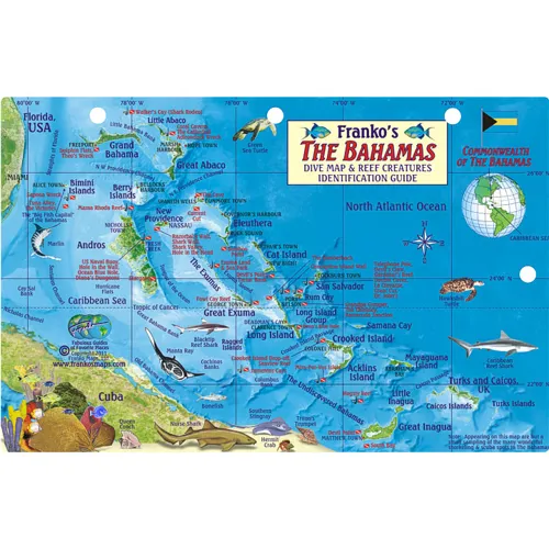
Between 20° and 28° latitude and 70°-80°W longitude is the archipelago of small islands that contain the Commonwealth of the Bahamas. The islands are located off the southeast coast of Florida and bounded on the south by Cuba present amazing opportunities for divers, fishermen and snorkelers. They include Bimini Islands at the western edge, Great Exuma, Long Island Group and Crooked Island in the middle, and Great Inagua to the southeast. In the warm, shallow waters around all these islands, tropical fish, coral reefs and shipwrecks abound. The Bahamas, after all, were infamous for pirating during the slave trade in the 19th century and were a haven for the pirate, Blackbeard.
In 1718, the Commonwealth of the Bahamas became a British Crown colony but in 1973 took its independence, retaining Queen Elizabeth II as its monarch. With tourism the main economic activity, hundreds of thousands visit the islands each year, many on cruise ships. If you love snorkeling, you'll find a huge array of angelfish, parrotfish, groupers, hogfish, wrasse and butterfly fish in and around the sponges, sea fans and sea anemone that abound in the reefs. Don some gear and make snorkeling a group activity on any of the main islands in the archipelago. There are dozens more tropical creatures to discover and admire, including several species of sharks and barracuda that can be found around the underwater caves and valleys. Scuba divers in these waters head to sites like Telephone Pole, Coral Cavern and The Cathedral; Theo's Wreck, Diana's Dungeons and many other spots where in the past pirate attacks caused ships to go down with treasured cargo.
Alice Town in the Bimini Islands is, of course, the Big Fish capital of the Bahamas where marlin fishermen head. Nassau, on New Providence Island, is the capital of the Commonwealth. Temperatures in The Bahamas fluctuate about 12°F (7°C) between the coolest months (January-February) and the warmest months (July-August) making for a reliably temperate climate with little rainfall. - A tropical savannah climate. The fish card measure (H x L) 5.5" x 8.5" (14cm x 21.6cm), is printed on laminated plastic so that it is stiff, shiny and waterproof. It has a hole for a lanyard, so you can actually take it diving or snorkeling. Note that the card is sized just right for 3-ring binder-type dive logs. Divers who keep dive log booklets can put this card into their log book to keep track of where they've been, plus what species of fish they've seen. Card makes a great gift idea.