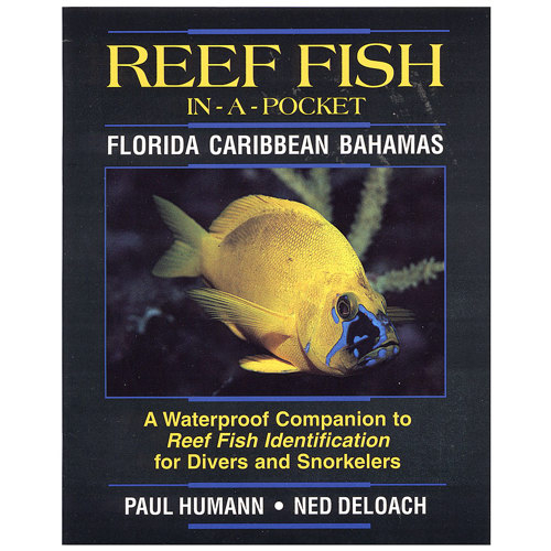
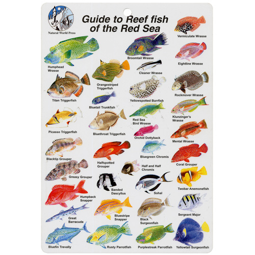
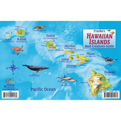
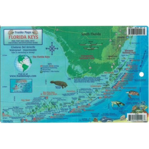
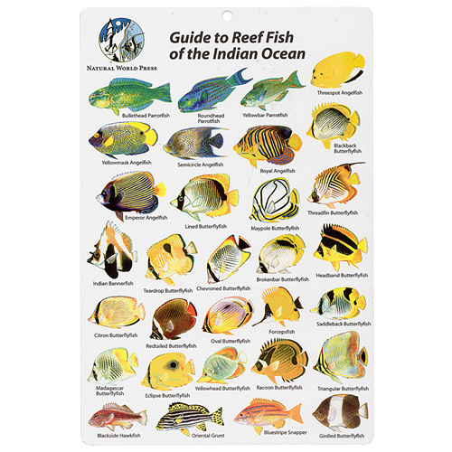
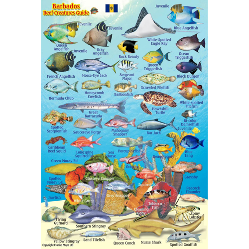
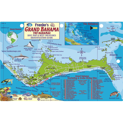
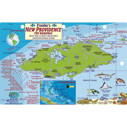
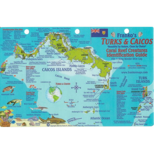
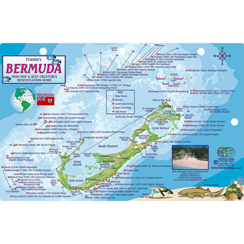
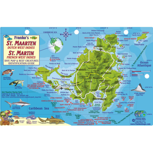
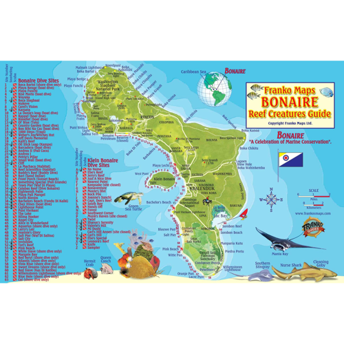
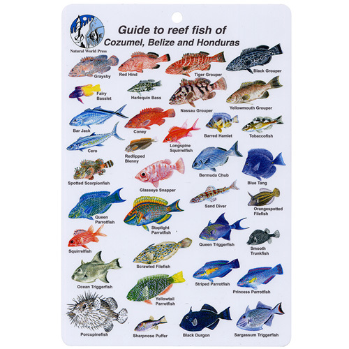
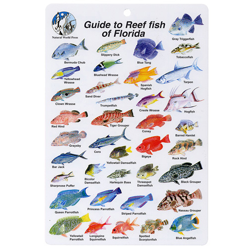
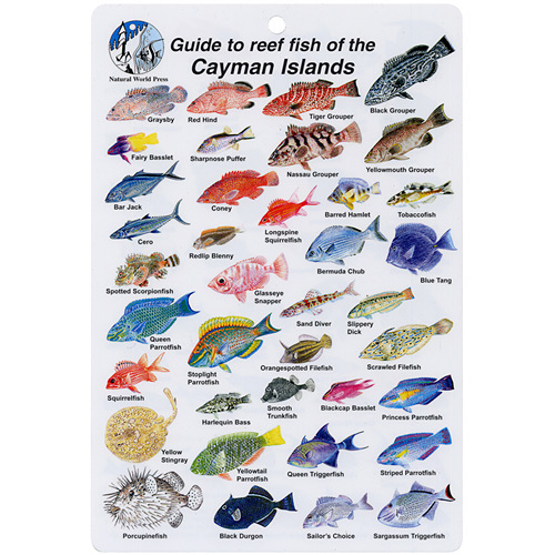
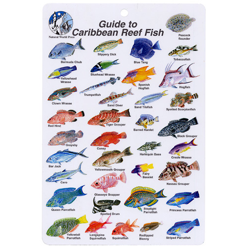
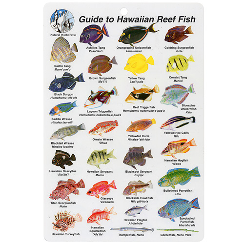
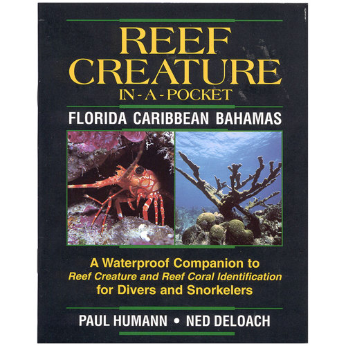
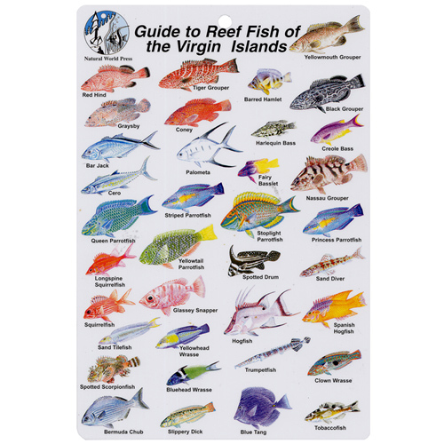
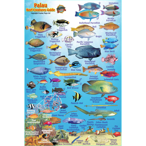
Exploring the vibrant world beneath the waves is a passion shared by divers, snorkelers, researchers, and marine enthusiasts alike, and having a reliable reef fish map can transform any underwater adventure into an educational and memorable experience. Reef fish maps are much more than simple charts; they are essential tools for anyone seeking to understand the dazzling variety of species of reef fish that inhabit coral reefs, rocky outcrops, and coastal waters. Whether you’re planning a dive trip to the Florida Keys, preparing for a snorkeling excursion in the Caribbean, or simply wanting to expand your knowledge of local marine life, these maps offer a practical and visually engaging way to identify and learn about the fish you encounter. Many maps are designed with waterproof materials and vibrant illustrations, making them easy to use in the field, even with wet hands or while floating just above a reef. For those interested in florida keys reef fish identification or exploring the diversity of a specific region, options like a caribbean reef map or location-specific guides can provide invaluable insight, often highlighting endemic and notable species you might spot during your underwater journey.
Reef fish identification is a skill that grows with experience, but even seasoned divers and snorkelers benefit from having a comprehensive reference at hand. Reef fish maps are particularly useful for group outings, family vacations, or dive club events, where sharing knowledge enhances the collective experience. They make thoughtful gifts for scuba divers, marine biology students, or anyone with a curiosity for the ocean—imagine the delight of a young snorkeler matching a colorful parrotfish to its illustration, or a diver logging their first sighting of a rare angelfish. During the warmer months, as water temperatures rise and visibility improves, more people take to the sea, making these resources especially timely for planning safe, informed, and enriching outings. Many maps also include helpful information such as local regulations, protected areas, and tips for responsible wildlife interaction, supporting both conservation efforts and personal safety. Whether you’re cataloging sightings for a personal logbook, preparing for a marine science project, or simply enjoying the beauty of the reef, these maps serve as a bridge between curiosity and discovery, connecting people of all ages to the wonders of the underwater world.
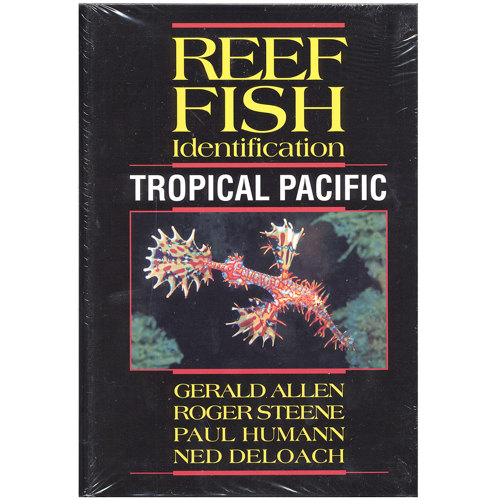
For those looking to expand their collection or find a specialized guide, there are a variety of formats to suit every need—from compact, laminated cards perfect for tucking into a wetsuit pocket, to detailed wall charts ideal for classrooms or home offices. Digital maps and interactive tools are also available, offering GPS coordinates, topographical details, and up-to-date habitat information for the tech-savvy explorer. Anglers, conservationists, and educators alike find value in these resources, whether tracking the movement of scuba fish across reef systems or monitoring changes in fish populations over time. If your adventures extend beyond diving and you’re interested in identifying fish while snorkeling, you’ll find a curated selection of
Snorkeling Fish Maps to enhance your experience. With the right map in hand, every trip underwater becomes an opportunity for learning, appreciation, and connection to the extraordinary life that thrives beneath the surface.